While having a car in Scotland provides more opportunities for going away, many Glaswegians rely on public transport when living in the city. However, you don’t need a car to go on a nice hike, so we’ve compiled a list of walks near Glasgow you can get to via public transport.

Those after a proper hike on the hills can enjoy a day out climbing The Cobbler, boasting superb views of the Southern Highlands, including Ben Lomond. Located around an hour and a half via public transport from Glasgow, the 11km (6.75 miles) hike takes between four and six hours to complete. Expect some steep rocky sections during the descent, but the paths are mostly clear.
How to get there: The easiest way to get to the start of the trail is by train, but there is also a bus. The Glasgow Queen Street to Arrochar / Tarbet service has a link path to The Cobbler and takes one hour 17 minutes. You can find out more about the full walk here.
The West Highland Way is known as one of the best walks in the world, spanning over 96 miles, and can be reached via public transport from Glasgow. Its diverse terrain keeps the hike varied, and it takes around a week to complete in its entirety. However, you don’t have to do the whole trail to enjoy the hike – taking a train to Milngavie to the Southern part of the West Highland Way can make for a lovely day out on the trail to explore Loch Lomond and visit Luss before going back to the train station.
How to get there: Taking the train from Glasgow Queen Street to Milngavie only takes 23 minutes. The start of the West Highland Way is marked by a stone obelisk on Douglas Street, and you can read about the first leg of the hike here.
Alva Glen is a delight for those who love waterfalls and shorter walks without climbing huge hills. The hike itself is only 2.5km (1.5 miles), and takes an hour and a half to complete from the car park. Expect a dramatic path, stunning views and a narrow slippery return – so, it’s still not the easiest walk to do! Hikers are warned to take care on the slopes, and those who want to be more risk-averse can just retrace their steps back to the car park.
##How to get there: Take the train from Glasgow Queen Street to Stirling, then change onto the 52 bus in the direction of Alloa, getting off at Johnstone Arms Hotel. From there, it is an 8-minute (450 meter) walk to the Alva Glen car park. The whole journey from Glasgow should take around one hour and 15 minutes, and up to an hour and a half if there are delays. You can find the walk details here.

This is one of the best walks near Glasgow, just 50 minutes from the city via public transport. Dumgoyne and Earl’s Seat walk takes around four and a half hours to complete, spanning over 10.5 kilometres. Hikers can visit the trail all year-round and admire at the volcanic plug that is Dumgoyne, as well as the highest point in the Campsie Hills, Earl’s Court. As always, bring waterproof hiking shoes, as the path gets steep and boggy at times.
How to get there: Take the train to Milngavie from Glasgow Queen Street, then change onto the X10 bus to Glengoyne Distillery. You can read more about the hike here.
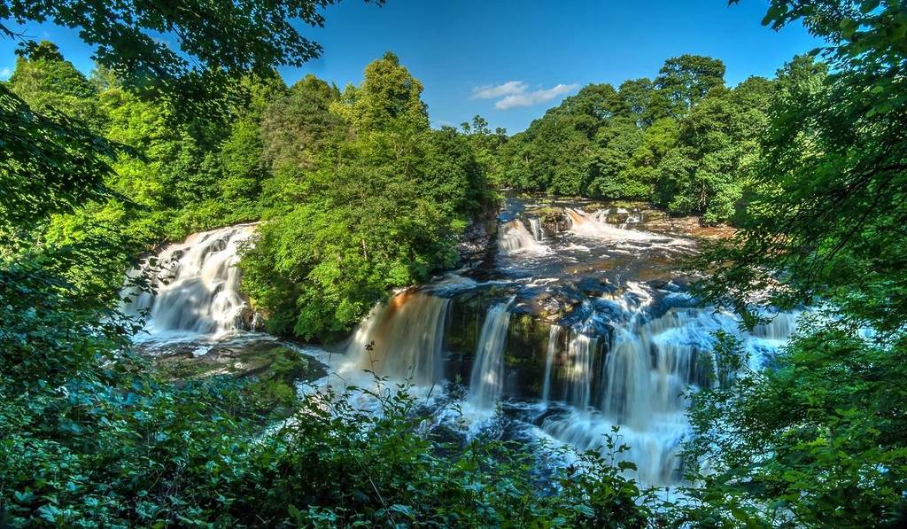
It wouldn’t be the best public transport walks near Glasgow list without the Falls of Clyde. The spot not only boasts the amazing waterfalls (so close to Glasgow, too), but also lovely riverside woodland walks and plenty of wildlife watching opportunities, such as bats, badgers, otters and ravens. Plus, there is an interactive visitor centre with badger camera footage, wildlife facts and games. The walk takes around two hours to complete, with a clear path with steps throughout. You can find more information here.
How to get there: Take the train to Lanark from Glasgow Central station, and walk 1km (0.6 miles) to the start of the trail at the World Heritage Site of New Lanark.